Traditional place names and coastal maps of Doolin and the Burren — Visitor guide
When you step off the bus in Doolin or stand at the edge of the Cliffs of Moher you are also stepping into a landscape written in names. Learning a few traditional Irish place‑name elements and how they appear on coastal maps makes it far easier to recognise viewpoints, pick safe walking routes, and connect what you see on a hillside or shoreline with the names locals use every day.
Book a Cliffs of Moher tour and plan your Doolin–Burren visit — use guided options to get the most from cliffside viewpoints, local history and practical navigation tips from experienced guides.
Why traditional place names matter for Cliffs of Moher visitors
Place names are compact guidebooks. They describe landforms (headlands, hollows, hills), human history (church sites, forts) and practical features (harbours, fords). Around Doolin and across the Burren, Irish (Gaeilge) names were anglicised over centuries; many maps and signs show both forms. A little recognition helps you match a name on a map to the terrain you’re seeing on the ground: “Ceann” or “head” means a promontory with views; “Poll” points to a sinkhole or hollow in the karst; “Kil” indicates a church or early monastic site worth noting if you plan short detours.
Common Irish place‑name elements and what they tell you
Here are the most useful elements to learn for Doolin and the Burren area, with simple meanings and how they relate to landscape or visitor interest.
Bally‑ (Baile)
Meaning: town, homestead. Bally appears in many village and town names (Ballyvaughan) and points to settled places with services or accommodation.
Kil‑ (Cill)
Meaning: church. Kilshanny, for example, indicates an early church site. These places often have historic ruins or graveyards that are visible from local lanes.
Inis‑ (Inis)
Meaning: island. Inis Oírr (Inis Oirr) is one of the Aran Islands you can day‑trip to from Doolin — see the practical walking route for cliffs on the island in our Inis Oirr guide. Islands are destinations for boat trips and coastal routes.
Lough / Loch
Meaning: lake. Lough names indicate inland water features. In the Burren, seasonal turloughs (temporary lakes) can appear in low hollows after rain — watch for “Lough” on maps where water may collect.
Knock / Cnoc
Meaning: hill. Cnoc or Knock marks a rise in the ground — useful when planning a viewpoint or avoiding unexpected climbs on a walk.
Ceann
Meaning: head or headland. Ceann appears in headland names — these are the obvious coastal viewing sites and places to expect cliffs, stacks, or promontories such as the southern reaches of the Cliffs of Moher.
Poll, Port, Bun, Rath
Poll indicates holes, sinkholes or pools common in karst limestone. Port or harbour names show boat landings or piers (Doolin Pier). Bun often means river mouth or bottom; Rath indicates ringforts or ancient settlement traces visible in the landscape.
How bilingual signs and anglicised names appear on local maps and road signs
In Clare you will commonly see two forms: the Irish name (Gaeilge) and an anglicised form that may look or sound different. On many official road signs the Irish version is displayed first, followed by the English. On tourist maps and guidebooks you’ll often find the anglicised name used alone. When using maps, check both names—OS or tourist maps may favour the English form, while local signs may display the Irish spelling and pronunciation.
On digital maps you can toggle language settings; on paper maps the place‑name form printed depends on the mapmaker. If a sign shows only Irish, look for matching phonetic letters or familiar elements such as “Bally” or “Kil” to confirm the place.
Using coastal maps for walking and viewpoint planning: map types and what to look for
Not all maps are equal for coastal walking. Here are the key map types and how to use them around Doolin and the Cliffs of Moher.
Topographic maps (paper or digital)
Look for contour lines, cliffs, and named headlands. Contours show steepness; closely packed contours at the coast warn of sharp drops. Topo maps also mark paths, minor roads and ancient sites (kil, rath).
Coastal or tourist maps
These highlight viewpoints, parking and trails. They’re helpful for quick planning, but always cross‑check with a topographic map for elevation and route safety.
OS or national mapping services
Ordnance Survey maps have detailed place names and features. For navigation, bring a printed extract or an offline digital map; mobile signal can be patchy along the coast, so offline access is essential.
Satellite and hybrid maps
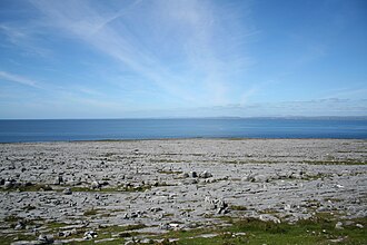
Satellite imagery helps match names to landscape features — you can spot piers, cliff edges, quarries and the unique Burren karst limestone pavement. Use this alongside topo maps to confirm paths and access points.
Pronunciation tips and simple strategies for asking locals and following directions
Pronouncing Irish names perfectly is not essential, but trying helps build rapport. A few safe rules:
- Break names into syllables and speak slowly. Locals appreciate the effort.
- Use the anglicised pronunciation if you’re unsure — it will be widely understood. For example, Poulnabrone is commonly pronounced “POOL‑na‑brown”.
- “Lough” is pronounced like “loch” (a soft throaty sound) or often anglicised to “lock”.
- Ask someone to repeat once and then repeat the name back — most people will correct gently if needed.
- Point at your map when asking for directions and combine the name with a simple phrase: “Where is [name]?” or “How do I get to [name]?”
Practical mapping examples for Doolin and nearby Burren features
Match these local names to landscape clues on your map and in the field.
Doolin village and Doolin Pier
Look for “Doolin” on maps near the shore; the pier marks departure points for boats to the Aran Islands and for coastal viewpoints. If you plan an island day‑trip, see our Inis Oirr walking route for practical advice.
Cliffs of Moher & Hag’s Head
Names including Ceann or Head indicate promontories. Hag’s Head is the southern tip of the Cliffs of Moher and a clear example of a headland name indicating dramatic coastal scenery. Contour lines and named headlands will guide you to formal viewing points and paths.
Poulnabrone and Burren karst features
On maps of the Burren look for Poll (sinkholes) and pavement symbols for limestone exposures. Poulnabrone Dolmen is a named archaeological feature in the karst — match the name on the map with the surrounding pavement to find parking and approach lanes. These features are often off main roads and require short walks on country lanes.
Ballyvaughan, Kilshanny and local hills
Town names starting with Bally are useful for finding services or bases. Kil elements such as Kilshanny point to church sites and small settlements. Cnoc or Knock will show hills to avoid or target for viewpoints — check contours for steep gradients.
Checklist: preparing maps and place‑name notes before a tour or self‑guided visit
Prepare this short list before you set out around Doolin and the Burren:
- Print or download a topographic map covering the Cliffs of Moher and Doolin with contour detail.
- Save an offline map on your phone (and a backup battery) in case signal is weak.
- Make a small list of local names you want to find (Doolin Pier, Hag’s Head, Poulnabrone, Inis Oirr) with simple phonetic notes.
- Mark parking, formal viewpoints and official paths on your map — avoid cliff edges off official routes.
- Check current official info for ferries, guided tour options and any temporary path closures before you go.
- Carry a paper compass or use a reliable GPS app when crossing open karst terrain in the Burren.
For tips on picture composition and choosing the best panoramas once you find those headlands, see our photography advice for the Cliffs of Moher. If you plan a music‑and‑islands day from Doolin, our Aran Islands folk music and storytelling guide shows how place names feature in local tradition.
Book a Cliffs of Moher tour and plan your Doolin–Burren visit — guided tours help link place names to landscape with expert local commentary. For groups or private arrangements, enquire about private or group tours tailored to map‑based walks and photography stops: Enquire about private or group tours.
Final practical tips
When following names on coastal maps remember: the Burren is karst limestone with uneven ground; stick to marked paths where possible. Match contour lines with place‑name elements (Ceann = headland; Cnoc = hill; Poll = hollow) to avoid surprises. If in doubt, ask at local visitor services — see our Doolin Visitor Essentials for current services and facilities — and always check official sources for up‑to‑date access information.
FAQ
Why do some place names appear in both English and Irish on signs and maps?
Many place names have an original Irish (Gaeilge) form that predates English spellings. Road signs and official maps often display both. Irish names are used to preserve language and heritage; anglicised forms became common during mapping and administration. You will frequently see both on signs around Doolin and the Burren, and it helps to recognise key elements in either language.
How can I safely pronounce local place names when asking for directions?
Speak slowly, break names into syllables, and use anglicised pronunciations if you’re unsure. Pointing at a map or sign while asking is an excellent strategy. Locals appreciate the attempt and will typically repeat or correct with a smile.
What map types or resources should I bring for coastal walking around Doolin and the Burren?
Bring a detailed topographic map (paper or offline digital), an offline satellite or hybrid layer for visual confirmation, and a compass or reliable GPS app. Tourist maps are useful for services and viewpoints but cross‑check with contour maps for steepness and access. Always check current official information before setting out.
Will knowing traditional place names help when booking or taking a Cliffs of Moher tour?
Yes. Knowing key place‑name elements helps you choose the right tours, ask targeted questions, and spot locations on a map during the tour. Guides often reference both Irish and anglicised names; being familiar with them enhances your understanding and the quality of your visit.